ST. GEORGE — Crews are working to contain a wildfire started by lightning Wednesday afternoon in the Grand Canyon-Parashant National Monument.
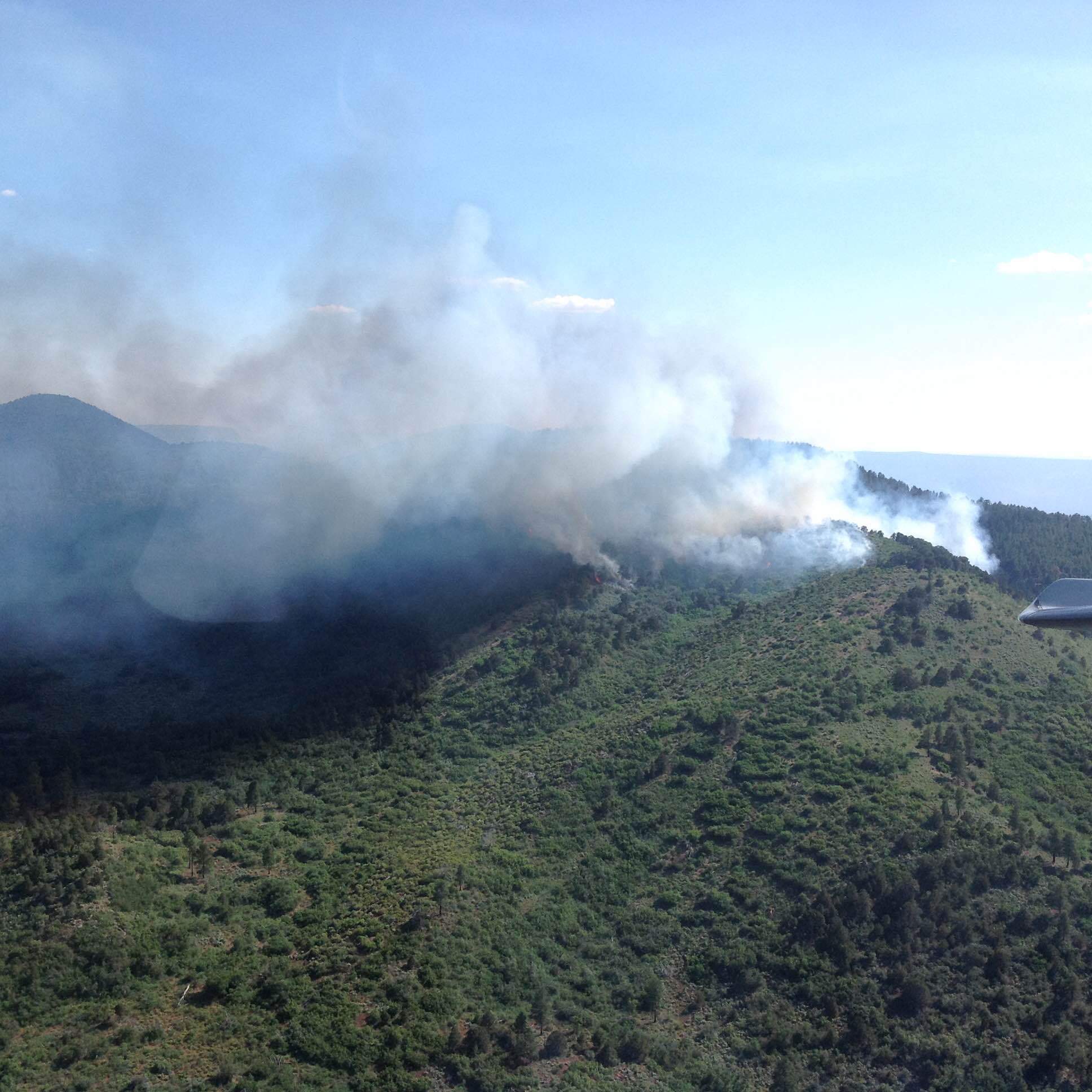
The Mt. Emma Fire started at approximately 4:40 p.m. and has burned 194 acres in a remote area about 75 miles southeast of St. George.
Fire staff from the Bureau of Land Management Arizona Strip District responded to a smoke report Wednesday from field staff and the Black Rock Lookout.
The fire began burning into a remote portion of the Grand Canyon National Park Thursday morning.
Resources on the fire include one group of smoke jumpers, one hot shot crew, one Type 2 initial attack crew and one Type 3 helicopter. The fire is burning in open Ponderosa pine, pinyon and juniper.
Fire managers are using both direct and indirect approaches for fire suppression on the Mt. Emma fire. The remote, mountainous terrain in which the Mt. Emma fire is burning requires fire management to balance suppression efforts with the primary goal of fire fighter safety.
“This is a suppression fire that we are taking action on with resources on the ground,” BLM Arizona Strip Public Affairs Officer Rachel Carnahan said. “We’re using both indirect and direct suppression tactics on this fire, which is necessary in this kind of remote, rugged terrain. Access to reach the fire is difficult, so we’re working to balance fire fighter safety — which is paramount — with feasible suppression tactics.”
The fire is burning within the footprint of the 1999 Emma Fire, which burned 1,286 acres. It is also located northwest of the 2005 Tuweep fire, which burned 1,866 acres.
There are no road or trail closures anticipated at this time. The public is urged to use caution when traveling in the area. Smoke may be visible from St. George.
Related posts
- Locust Fire update, preparation for weekend thunderstorms
- House fire causes estimated $25,000 in damages; STGnews Videocast
- News short: Fire ignites in backyard near River Road
Email: [email protected]
Twitter: @STGnews
Copyright St. George News, SaintGeorgeUtah.com LLC, 2015, all rights reserved.