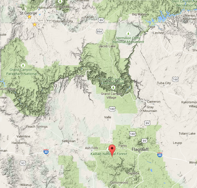
WILLIAMS, Ariz. — The Springs Fire, located 9 miles south of Williams east of Davenport Knoll and 2 miles south of Summit Mountain on the east side of County Road 73, grew to 168 acres in size. The fire, in the Williams Ranger District of Kaibab National Forest, is being managed to enhance forest health and wildlife habitat while reducing the potential for high-intensity wildland fires in the future.
Fire and Weather Behavior
The Springs Fire behavior remains low intensity while all perimeters remain active. The fire grew on 3 sides except on the northeast borders of Forest Road 354. There is a possibility of light smoke in the Sherwood Forest Estates subdivision and from Interstate 40 in the Parks area west to Williams.
As Hurricane Dolores spins off the coast of the Baja, Mexico, it will prompt a surge of moisture from the Gulf of California. This means an increased chance of rainfall across Arizona by today and into the weekend. The possibility of stronger thunderstorms, that could produce flooding, will also increase. Fire growth is expected to be slow.
Safety
Whenever firefighters and their vehicles are present along the County Road 73, also known as the South Road, motorists should slow down and limit distractions to help keep everyone safe when driving through the fire area.
There are no closures in effect related to the Springs Fire.
Related posts
- Lightning starts High Meadow Fire in Grand Canyon-Parashant National Monument
- Williams Ranger District: Springs, Key Hole, Mason fires
- Cathedral Fire burns on; final update, barring significant change
Email:[email protected]
Twitter: @STGnews