ST. GEORGE — Much like the Lake Powell Pipeline project, the so-called “Northern Corridor” has been a contested topic for over a decade. Now, like the pipeline, the public has a limited time the comment on the roadway project that would cut through a portion of protected desert tortoise habitat.
The Bureau of Land Management announced earlier this month that it is accepting public input on the proposed Northern Corridor project in order to best gauge the environmental and human impact the project could have if allowed to move forward.
The comment period began Dec. 5 and runs through Jan. 6. A public meeting where people can learn more about the project will be held at the Dixie Convention Center, 1835 Convention Center Drive, St. George, Tuesday from 4:30-7:30 p.m.
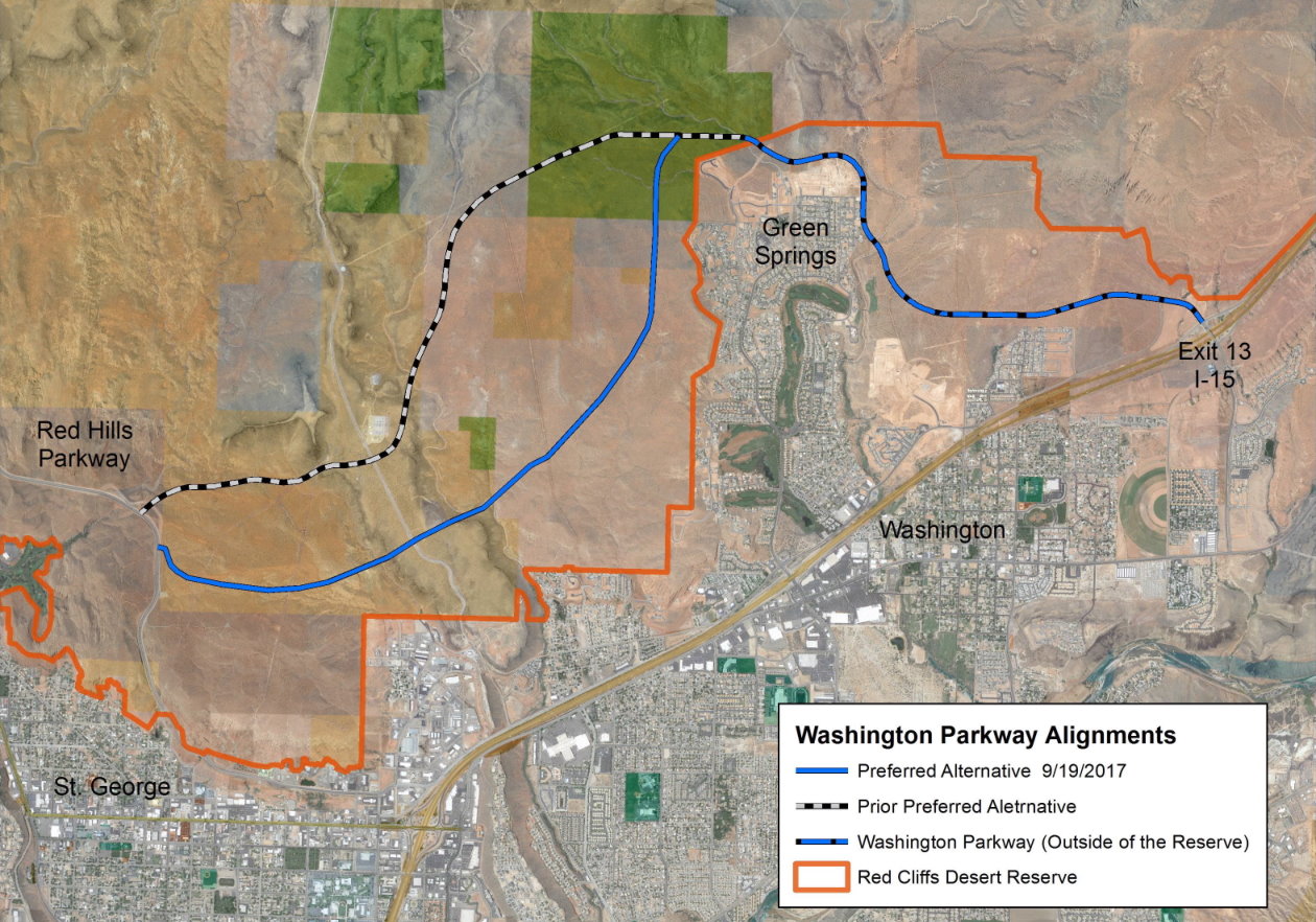
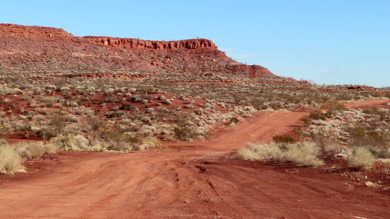
The current alignment proposed by road planners – which would connect to Interstate 15 via Washington Parkway on the east end and Red Hills Drive on the wast end – would cut across parts of the Red Cliffs Desert Reserve and overlap Red Cliffs National Conservation Area.
The reserve was created over 20 years ago for the protection of the threatened Mohave desert tortoise.
State and local road planners and civic officials say the corridor is needed in order to accommodate the county’s continuing growth or the road system will fail. They say the roadway was also promised to Washington County by the federal government long ago.

“All of our traffic studies show that within the next 10 years our traffic system is going to fail (without the Northern Corridor),” Washington County Commissioner Victor Iverson said.
Opponents argue the reserve and national conservation area are meant to preserve the tortoise and natural wonders of the area and shouldn’t be carved up for a roadway. They also fear what kind of precedent this action could set for national conservation areas elsewhere if successful.
The Utah Department of Transportation and the county’s request to the BLM and the U.S. Fish and Wildlife Service for a right-of-way for a four-lane highway through the protected land is the latest in a series of attempts to secure a designated route for the roadway.
Previous attempts, including congressional legislation proposed by members of Utah’s congressional delegation, have failed to achieve this.

Gathering comments from the public is a requirement of the National Environmental Policy Act, or NEPA. The comments will be reviewed by specialists and added to a draft environmental impact statement (EIS) that will analyze the right-of-way proposal for the Northern Corridor.
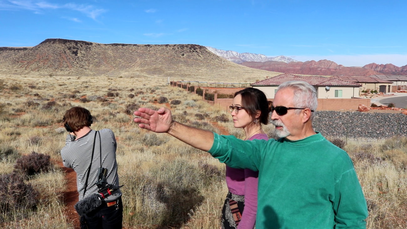
“That is why comment periods like this one are so important,” Sarah Thomas, lands program manager for Conserve Southwest Utah said during a field trip with reporters to points on the Northern Corridor’s route through the desert reserve.
“We want everybody who lives here to have a voice, and have a voice in how we shape Washington County,” she said.
Conserve Southwest Utah is among the groups opposed to the roadway project.
Of tortoises and transportation
The 62,000-acre Red Cliffs Desert Reserve was created in 1995 as a means to allow development in Washington County to continue unhindered by the presence of the Mohave desert tortoise.
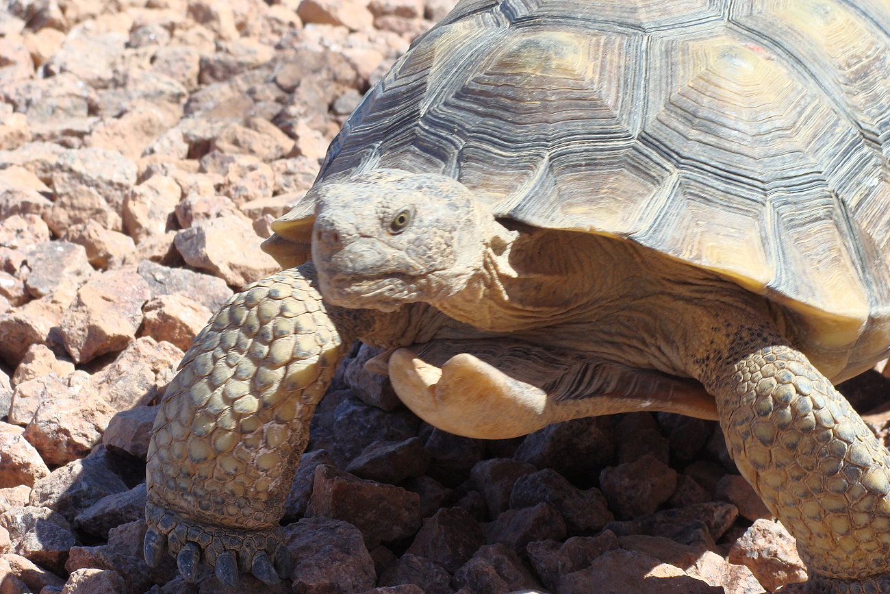
The tortoise is listed as “threatened” under the Endangered Species Act. As the tortoises are found across the county, their presence had the possibility of halting future growth as their habitat could also become protected under federal law. Instead, the Red Cliff Desert Reserve was created as a place the tortoise could be relocated to so their presence wouldn’t be disruptive to the county’s continuing growth.
“If you’re a resident of Washington County and you have a house that was built after 1996, you live here as a result of the Washington County Habitat Conservation Plan,” Thomas said. “That’s the plan that allows your house to be constructed on tortoise habitat.”
The Washington County Habitat Conservation Plan (HCP) is a joint effort between the county and federal agencies like the Fish and Wildlife Service that guides the HCP’s management. The plan also expired in 2015. While granted an extension by the Fish and Wildlife Service, the Northern Corridor, among other outstanding issues, has played a part in delaying the HCP’s renewal.
Local civic leaders say a future east-west right-of-way across the reserve was meant to be a part of the original HCP. It was also reinforced in the 2009 Omnibus Public Lands Act of 2009, they argue, claiming the BLM was supposed to designate the route soon after that legislation’s passing.

Because the road would cut through land set aside for the protection of the threatened desert tortoise, federal wildlife and lands officials were reluctant to approve it. They rejected routes proposed by county road planners because they were not seen as being compatible with federal environmental protection policy.
Previous attempts to move the Northern Corridor forward were made by Sen. Mike Lee and Rep. Chris Stewart, Utah Republicans who proposed legislation mandating the BLM designate a right-of-way for the corridor. The legislation died when the Democrats took control of the House of Representatives following the 2018 midterm election.
A piece of the legislation that is being revisited as part of the proposed roadway project is the creation of what is tentatively called “Zone 6.” Set west of Bloomington and south of Santa Clara, this area covers nearly 7,000 acres that would become an extension of the desert reserve in order to offset the impacts created by the construction of the Northern Corridor.
Despite differences in opinion and priority related to the Northern Corridor, members of the Washington County Commission, such as Commission Dean Cox, have previously stated that the county and BLM enjoy a good and cooperative relationship.
Challenge of growth and geography
Still, road planners and civic officials declare an urgent need for the Northern Corridor due to the county’s continuing growth.
In recent years, the St. George area has been listed as one of the fastest-growing metropolitan areas in America, according to the U.S. Census Bureau. Estimates from the University of Utah place Washington County’s population at around 500,000 by 2065.
With that growth comes many challenges, transportation being among them.
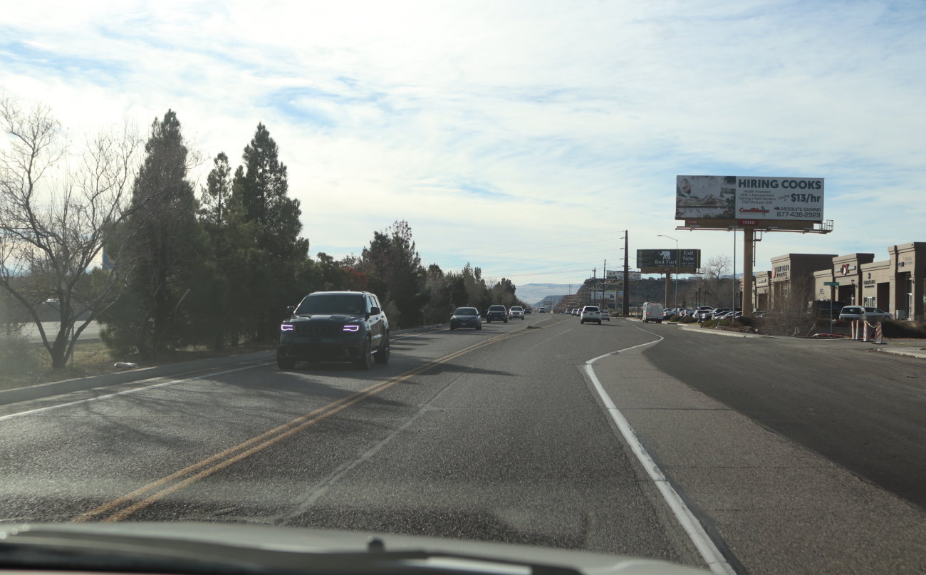
Currently, the major east-west corridor in Washington County between I-15 and the western side of the county is Sunset Boulevard to Bluff Street to St. George Boulevard, according to the Utah Department of Transportation.
While improvements have been made to Bluff Street in order to accommodate increasing traffic, road planners have said the road system will fail and become awash in congestion if the Northern Corridor isn’t built. There are also environmental concerns as the congestion could negatively impact the county’s air quality.
The local landscape also doesn’t help matters as far as planning for future roadways goes.
“Southern Utah is full of geographic roadblocks and checkpoints,” outgoing Washington City Councilman Troy Belliston said. “There are only so many places you can put a road here.”
The western end of the Northern Corridor is projected to pass through Washington City and in the “backyard” of the Green Springs development. This possibility is a source of consternation for some Green Springs residents.
Proposed alternatives and stressing the need to comment
During a field trip last week at which representatives of Conserve Southwest Utah took members of the media to points along the proposed roadway’s route, they said the conservation group had been attempting to helping Green Springs residents organize in opposition to the project.
“All of these homes we’re seeing in the process of being built (in Green Springs), all of these residences will have a busy, four-lane highway in their backyards,” Thomas said.
While Thomas continually stressed the need for the public to submit comments on the Northern Corridor during the time limit allowed, she also said the potential approval of a roadway through protected public lands would set a worrisome precedent.
“A decision to build a highway through already protected public lands would be precedent-setting for our country,” Thomas said in an email following the field trip. “If it can happen in Washington County, it can happen in other regions in Utah and, frankly, throughout our country. It puts at risk America’s National Conservation Lands (of which Red Cliffs NCA is a part) as well as long-established laws and agreements such as the Endangered Species Act.”
The Red Cliffs Desert Reserve and accompanying national conservation area – which was established in 2009 – are for the preservation of the desert tortoise and other natural wonders found therein, not “traffic management and transportation enhancement,” said Tom Butine, Conserve Southwest Utah’s board president.
Butine said he wasn’t sure if the assumptions and projections used by Washington County for its future road plans were correct. Conserve Southwest Utah has wanted to look at the numbers, but claims to have been denied the opportunity by the county.
Despite this, Conserve Southwest Utah has proposed alternatives to the Northern Corridor that are cataloged in its Community Transportation Alternatives posted on its website.
Among the alternatives proposed is converting Buena Vista Boulevard and Red Hills Parkway between the Bluff Street and Washington Parkway into a four-lane highway in place of the Northern Corridor.
“Why not take this road (Red Hills Parkway) that’s a terrific east-west connection from Ivins and Santa Clara along the north side of St. George and why not connect it with I-15?” Butine said.
Additional enhancements to the roadway would involve removing traffic signs and traffic lights in order to promote more efficient travel.
Other alternatives include:
- Creating flyover viaducts connecting Red Cliffs Parkway to I-15 starting around 100 East;
- Improvements on Red Hills Parkway between I-15’s Exits 8 and 10 (St. George Boulevard and Green Springs) to reduce congestion, such as widening the roadway to six lanes and adding roundabouts and blocked access to minor roads and other access points in the area;
- Making I-15 more porous by constructing new underpasses at South 400 East, South 700 East and South 1240 East.
In regard to turning Red Hills Parkway into a Northern Corridor alternative, Iverson said that option has been looked at, but would be a nightmare in relation to dealing public domain issues and cost.
Below are the items federal officials are asking to the public’s input on, courtesy of the Federal Register:
- Whether the BLM will approve a 1.75-mile right-of-way section of the approximately four-mile-long Northern Corridor project that crosses the 62,000-acre Red Cliffs Desert Reserve and the 45,000-acre congressionally-established Red Cliffs National Conservation Area (NCA).
- Whether the BLM will amend the Red Cliffs NCA Resource Management Plan (RMP) to allow for a transportation ROW and/or corridor within the NCA.
- Whether the BLM will amend the St. George Field Office RMP to modify management on approximately 6,800 acres (Zone 6) outside the Reserve and NCA to offset the ROW impacts.
- Whether the U.S. Fish and Wildlife Service will issue an associated Incidental Take Permit for the Mojave desert tortoise for specific land use and land development activities in Washington County.
How to Comment
Comments may be submitted online at the BLM’s website, through email at [email protected]; or mail at Bureau of Land Management, Attn: Northern Corridor, 345 E. Riverside Drive, St. George, Utah 84790.
The public comment period ends Jan. 6, 2020.
Copyright St. George News, SaintGeorgeUtah.com LLC, 2019, all rights reserved.